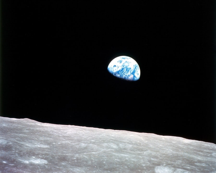
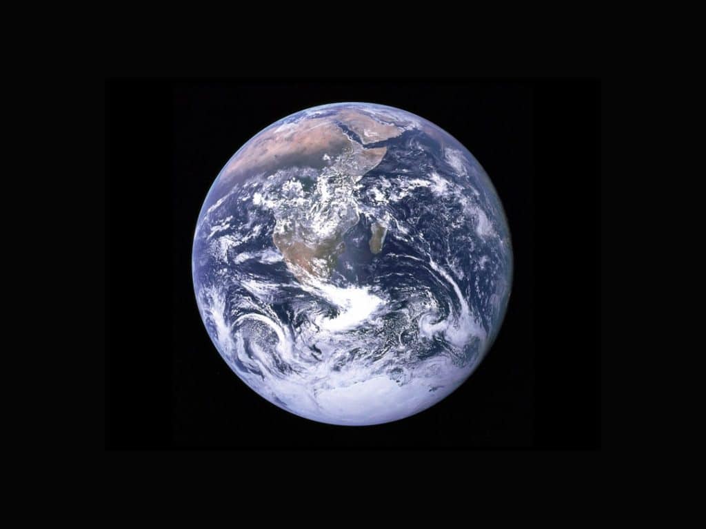
The Overview Effect is a profound psychological phenomenon experienced by astronauts when they view Earth from the vantage point of space. This transformative experience often leads to a deep sense of interconnectedness and a newfound appreciation for the planet’s beauty and fragility. As astronauts gaze down at the blue marble suspended in the vastness of space, they are struck by the thin atmosphere that envelops it, a delicate layer that sustains life.
This perspective shift can evoke feelings of awe and humility, as they realize that national borders, conflicts, and material concerns fade into insignificance against the backdrop of the planet’s grandeur. The Overview Effect has been documented by numerous astronauts who have shared their experiences upon returning to Earth. For instance, astronaut Frank White, who coined the term in his 1987 book “The Overview Effect: Space Exploration and Human Evolution,” describes how seeing Earth from space can lead to a profound change in consciousness.
Many astronauts report feeling a sense of responsibility to protect the planet, recognizing that it is a shared home for all humanity. This realization often inspires them to advocate for environmental stewardship and global cooperation, emphasizing the need to address pressing issues such as climate change and resource depletion.
Key Takeaways
- The Overview Effect is a profound shift in perspective experienced by astronauts when they see Earth from space, leading to a greater appreciation for the planet.
- Capturing Earth’s natural wonders from above provides a unique and breathtaking view of the planet’s diverse landscapes and geological formations.
- Understanding Earth’s fragile ecosystems becomes evident when observing the planet from space, highlighting the need for conservation and preservation efforts.
- Observing the impact of human activity on Earth from space underscores the importance of sustainable practices and environmental stewardship.
- Discovering the spectacular landscapes of Earth from space showcases the planet’s natural beauty and serves as a reminder of the need to protect and conserve these areas.
Capturing Earth’s Natural Wonders from Above
The ability to capture Earth’s natural wonders from above has been revolutionized by advancements in satellite technology and aerial photography. High-resolution images taken from space reveal breathtaking landscapes that are often hidden from view at ground level. For example, the stunning patterns of the Amazon rainforest, the intricate formations of coral reefs, and the vast expanses of deserts can be appreciated in their entirety only from an aerial perspective.
These images not only showcase the beauty of our planet but also serve as vital tools for scientific research and environmental monitoring. Satellites equipped with advanced imaging technology can capture detailed data about Earth’s surface, allowing scientists to study changes in ecosystems over time. The Landsat program, initiated in 1972, has provided a continuous record of Earth’s land surface, enabling researchers to analyze deforestation rates, urban expansion, and agricultural practices.
By examining these images, scientists can identify trends and make informed decisions about conservation efforts. The ability to visualize natural wonders from above not only enhances our appreciation for Earth’s beauty but also underscores the importance of protecting these fragile ecosystems.
Understanding Earth’s Fragile Ecosystems

Earth’s ecosystems are intricate webs of life that rely on delicate balances between various species and their environments. From lush rainforests teeming with biodiversity to arid deserts where life has adapted to extreme conditions, each ecosystem plays a crucial role in maintaining the planet’s health. Understanding these ecosystems is essential for effective conservation efforts, and satellite imagery provides invaluable insights into their dynamics.
For instance, remote sensing technology allows scientists to monitor changes in vegetation cover, water availability, and habitat fragmentation, all of which are critical for assessing ecosystem health. One striking example of this is the monitoring of coral reefs, which are among the most diverse ecosystems on Earth yet are highly vulnerable to climate change and human activity. Satellite imagery can track changes in water temperature and clarity, helping researchers understand how these factors affect coral health.
By analyzing this data, scientists can develop strategies to protect coral reefs from bleaching events and other threats. The ability to observe ecosystems from space enhances our understanding of their complexities and highlights the urgent need for conservation efforts to preserve these vital habitats.
Observing the Impact of Human Activity on Earth
| Metrics | Data |
|---|---|
| Carbon Dioxide Levels | 415 parts per million (ppm) in 2021 |
| Deforestation Rate | 10 million hectares per year |
| Global Temperature Rise | 1.2°C increase since the late 19th century |
| Plastic Pollution | 8 million tons of plastic entering the ocean annually |
Human activity has left an indelible mark on the planet, and observing these changes from space provides a unique perspective on our impact. Satellite imagery reveals the extent of deforestation, urbanization, and pollution, offering a stark reminder of the consequences of our actions. For example, the rapid expansion of cities can be clearly seen in before-and-after images taken over time, illustrating how natural landscapes have been transformed into urban environments.
This visual evidence serves as a powerful tool for raising awareness about environmental issues and encouraging sustainable practices. One notable case is the deforestation of the Amazon rainforest, often referred to as the “lungs of the Earth.” Satellite data has shown alarming rates of tree loss due to logging, agriculture, and infrastructure development. By monitoring these changes from space, researchers can identify hotspots of deforestation and work with local governments and organizations to implement conservation measures.
The ability to observe human impact on Earth not only informs policy decisions but also fosters a sense of accountability among individuals and communities regarding their environmental footprint.
Discovering the Spectacular Landscapes of Earth
The breathtaking landscapes of Earth are a testament to the planet’s geological history and natural processes. From towering mountain ranges to expansive plains, each landscape tells a story shaped by millions of years of evolution. Aerial photography and satellite imagery allow us to explore these diverse terrains in ways that ground-level views cannot capture.
For instance, the vibrant colors of the Grand Prismatic Spring in Yellowstone National Park or the intricate patterns formed by glacial activity in Patagonia can be fully appreciated only from above. Moreover, these spectacular landscapes are not just visually stunning; they also play critical roles in supporting biodiversity and regulating climate. Mountain ranges act as barriers that influence weather patterns, while wetlands serve as natural filters for water quality.
Understanding these landscapes through satellite imagery enables scientists to assess their ecological significance and develop strategies for their preservation. The exploration of Earth’s landscapes from above not only enriches our appreciation for nature’s artistry but also emphasizes the importance of safeguarding these irreplaceable environments.
Monitoring Climate Change from Space

Climate change is one of the most pressing challenges facing humanity today, and monitoring its effects from space has become increasingly vital. Satellites equipped with specialized sensors can collect data on atmospheric conditions, sea level rise, ice melt, and temperature fluctuations across the globe. This information is crucial for understanding the complex dynamics of climate change and its far-reaching impacts on ecosystems and human societies.
For example, NASA’s GRACE (Gravity Recovery and Climate Experiment) satellites have provided invaluable insights into changes in groundwater storage and ice mass loss in polar regions. By measuring variations in Earth’s gravitational field, scientists can track how much ice is melting in Greenland and Antarctica, contributing to rising sea levels. Additionally, satellite data has been instrumental in monitoring greenhouse gas emissions from urban areas and industrial sites, helping policymakers identify sources of pollution and develop targeted mitigation strategies.
The ability to observe climate change from space enhances our understanding of its causes and consequences while informing global efforts to combat this existential threat.
Appreciating Earth’s Diversity from a Different Perspective
Viewing Earth from space offers a unique opportunity to appreciate its incredible diversity—both in terms of natural landscapes and cultural heritage. The planet is home to a myriad of ecosystems, each with its own distinct flora and fauna. From the icy tundras of the Arctic to the lush rainforests of the Amazon, each region contributes to Earth’s overall biodiversity.
Satellite imagery allows us to visualize this diversity on a grand scale, revealing patterns that may not be apparent from ground level. Furthermore, cultural landmarks such as ancient ruins or modern cities can also be appreciated from an aerial perspective. The intricate layout of historical sites like Machu Picchu or the Great Wall of China becomes more apparent when viewed from above, highlighting human ingenuity in harmony with nature.
This broader perspective fosters a deeper understanding of how diverse cultures have adapted to their environments over time. By appreciating Earth’s diversity through satellite imagery, we gain insight into the interconnectedness of all life forms and the importance of preserving both natural and cultural heritage.
Inspiring Environmental Conservation through Space Exploration
The exploration of space has not only expanded our understanding of the universe but has also inspired a renewed commitment to environmental conservation on Earth. The images captured by satellites serve as powerful reminders of our planet’s beauty and vulnerability, motivating individuals and organizations to take action in protecting it. Initiatives such as Earth Day have gained momentum as people recognize their shared responsibility for safeguarding the environment.
Moreover, space missions often emphasize sustainability as a core principle. For instance, NASA’s Artemis program aims not only to return humans to the Moon but also to establish sustainable practices for future exploration missions. This focus on sustainability extends beyond space exploration; it encourages a broader dialogue about how we can apply similar principles here on Earth.
By fostering a sense of stewardship through space exploration, we can inspire future generations to prioritize environmental conservation and work towards a more sustainable future for our planet. In conclusion, viewing Earth from space offers profound insights into its beauty, complexity, and fragility. The Overview Effect serves as a catalyst for change in how we perceive our planet and our role within it.
Through satellite imagery and aerial photography, we gain valuable perspectives on natural wonders, fragile ecosystems, human impact, climate change, diverse landscapes, cultural heritage, and conservation efforts. As we continue to explore space, we must also commit ourselves to protecting our home planet for generations to come.


